Telescope
| Parameter |
Details |
| Magnification |
30× |
| Field of View |
1°30′ |
| Tube Length |
154 mm |
| Min Focus |
1.2 m |
| Objective Aperture |
45 mm (50 mm EDM) |
| Reticle |
Adjustable brightness (5 levels) |
| Laser Pointer |
Red laser |
Robotic & Tracking System
| Parameter |
Details |
| Motor Type |
DC Servo |
| Rotation Speed |
60°/sec |
| Rotation Time |
2.9 sec (F1/F2) |
| Tracking Range |
3 – 600 m |
| Lock Time |
3 – 5 sec |
| AIM Accuracy |
±1 mm @ 100 m |
| Search Range |
360° horizontal, +18° vertical |
| Search Time |
~3.5 sec |
Tilt Sensor & Plummet
| Parameter |
Details |
| Tilt Sensor |
Dual-axis liquid photoelectric |
| Compensation Range |
±4′ |
| Laser Plummet |
Red laser (635 nm) |
| Accuracy |
±1.5 mm at 1.5 m |
System & Hardware
| Parameter |
Details |
| CPU |
MT6762 |
| Display |
5.5″ TFT LCD (720×1280) |
| OS |
Android 11 |
| Memory |
4GB RAM / 64GB ROM |
| Keyboard |
13 keys |
Connectivity
| Parameter |
Details |
| Interfaces |
USB-C (OTG), RS232 |
| Wireless |
Bluetooth (300 m), Wi-Fi |
| Network |
4G LTE (Micro SIM) |
| Storage |
TF Card |
Power Supply
| Parameter |
Details |
| Battery |
Li-ion 5400 mAh |
| Operating Time |
Up to 6 hours |
| Charging Time |
~4 hours |
| Charger |
110–220V |
Environmental & Physical
| Parameter |
Details |
| Operating Temp |
-20°C to +50°C |
| Storage Temp |
-40°C to +70°C |
| Protection |
IP55 |
| Humidity |
95% non-condensing |
| Dimensions |
217 × 198 × 378 mm |
| Weight |
7 kg |
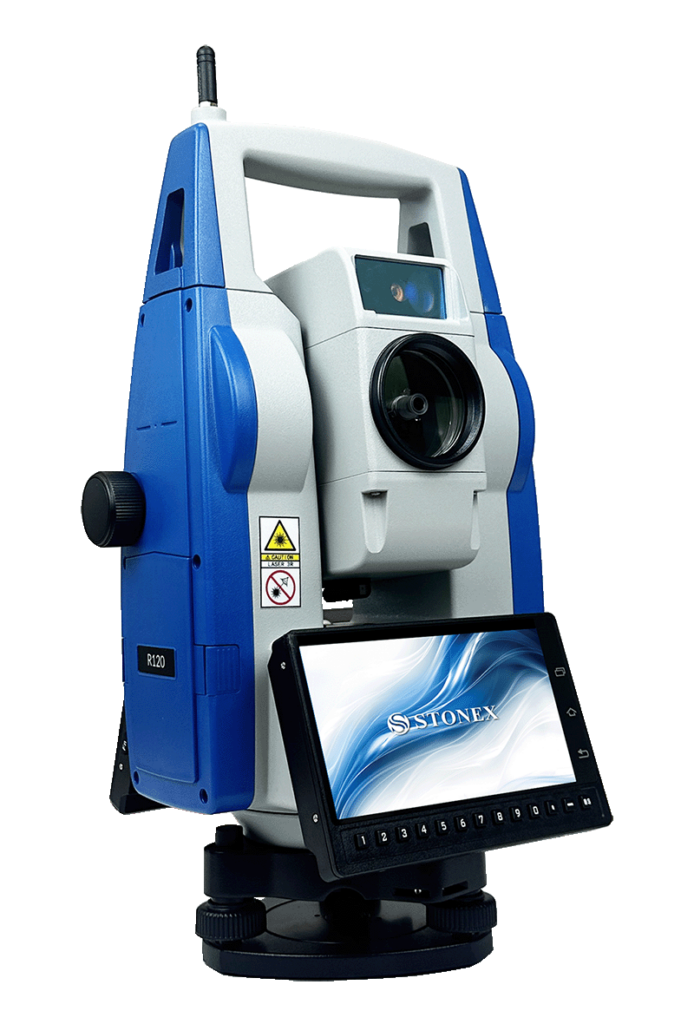
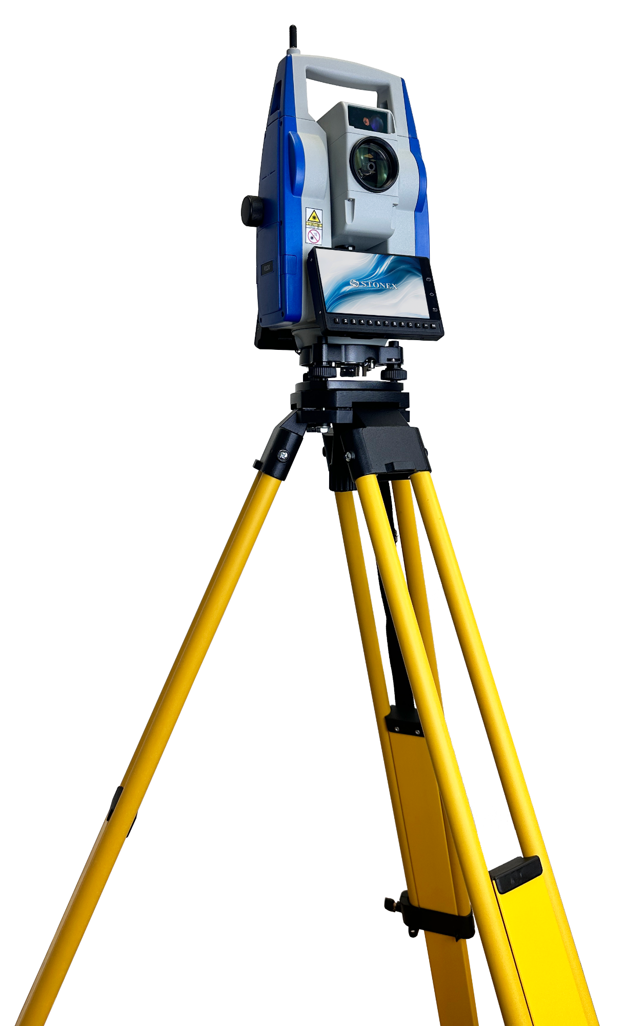
R120 Robotic Total Station
The Stonex R120 Robotic Total Station is a high-performance, fully motorized surveying instrument engineered for precision, automation, and efficiency in modern field operations. Equipped with advanced servo technology, automatic target tracking, and long-range reflectorless measurement capabilities, the R120 enables single-operator workflows with superior accuracy and speed.
Featuring a powerful onboard Android system, integrated long-range communication options, and intelligent automation functions such as Auto Prism Centering (APC) and Fast360 search, the R120 significantly enhances productivity in construction layout, topographic surveying, and infrastructure projects.
Key Features of R120 Robotic Total Station
High-Precision Angle & Distance Measurement
- Angular accuracy options: 1″ / 2″ / 5″
- Absolute continuous angle reading system with 0.1″ / 1″ resolution
- Distance accuracy:
- Prism: ±1 mm + 1 ppm
- Reflectorless: up to ±5 mm + 2 ppm
Advanced Robotic Automation
- DC Servo Motor with high-speed rotation up to 60°/sec
- Auto Prism Centering (APC) for automatic target locking and tracking
- Fast360 search for rapid prism detection
- Automatic target tracking range up to 600 m
Long-Range Measurement Capability
- Prism range up to 3,500 m
- Reflectorless range up to 1,000 m
- Fast measurement times:
- Prism: 0.1 – 0.3 sec
- Reflectorless: 0.3 – 3 sec
Smart Android-Based Operation
- Integrated Android 11 operating system
- Large 5.5” TFT LCD touchscreen (720 × 1280 px)
- Built-in field software: Cube-a TS-GPS
- Powerful processing: 4GB RAM / 64GB ROM
Comprehensive Connectivity
- 4G network support (Micro SIM)
- Bluetooth (long-range up to 300 m)
- Wi-Fi (WLAN)
- USB Type-C (OTG), RS232, TF card support
Robust & Field-Ready Design
- IP55-rated for dust and water resistance
- Operating temperature: -20°C to +50°C
- Laser plummet and dual-axis tilt compensation
- Durable construction with 7 kg total weight
Applications
- Construction Layout & Stakeout
High-speed robotic operation for efficient single-person layout tasks.
- Topographic Surveying
Accurate and fast data collection for terrain modeling and mapping.
- Infrastructure & Road Projects
Ideal for alignment, monitoring, and control in large-scale projects.
- Cadastral & Boundary Surveys
Reliable precision for legal land measurements.
- Engineering & Monitoring
Suitable for deformation monitoring and structural analysis.
Key advantages
- Ships with Cube-a pre-installed
- Merges GNSS points and total station shots instantly
- Transfers data fast via long-range Bluetooth
- Connects to the internet with the built-in 4G modem
- Loads external GNSS surveys through Bluetooth and finishes them directly on the total station
You survey faster, stake out easier, and stay connected everywhere. Pure Android power in a robotic total station.


Reviews
There are no reviews yet.