
Why INTERGEO 2026 is the Must-Attend Event for Spatial Data & Surveying Professionals

As a longtime geospatial and surveying professional, there is only one industry event this year, make it INTERGEO 2026 in Germany this September – the world’s leading trade fair and conference for GIS, land management, BIM integration, and UAV mapping. Whether you are an enterprise GIS manager optimizing spatial databases, a licensed surveyor leveraging high-precision LiDAR, or a construction drone pilot, this premier expo offers direct access to cutting-edge geodata innovations, technical keynotes, and invaluable networking. Read on for our essential Q3 travel breakdown and actionable insider tips to help you justify your attendance, maximize your ROI, and secure your event pass today.
Core Themes: As spatial data moves from traditional land surveying into live digital twins, staying current on geoinformation workflows isn’t optional anymore. At this year’s summit, our lead geospatial engineers walk through real-world applications—showing you exactly how to integrate mobile LIDAR, IoT telemetry, and automated BIM pipelines directly into urban planning projects.
Conference: Beyond the exhibition floor, the 3-day technical conference brings together over 1,200 GIS specialists, geodetic engineers, and urban planners. Through live teardowns and peer-led break-outs, attendees walk away with tested strategies to solve real-world spatial data bottlenecks.

The International Leading Trade Fair for Geodesy, Geoinformation and Land Management
Join thousands of surveying, GIS, and smart city leaders at INTERGEO 2026 from September 15–17 at Messe München, Germany—the world’s premier trade fair for spatial intelligence, BIM workflows, LiDAR, and drone innovation. Discover hands-on tech demos, gain actionable strategies from top spatial data experts, and connect directly with enterprise decision-makers shaping our digital future.
The INTERGEO 2026 Conference runs alongside the expo, bringing together engineering leads, city planners, and spatial data experts for three days of practical technical sessions. Dive into real-world case studies on digital twins, automated surveying, and GIS integration to solve your toughest infrastructure challenges.
We are seeing a real shift across the industry this year. The conversation has moved past simple hardware spec bumps on total stations and laser scanners – now, it’s all about live data feeds, practical AI feature extraction, and how municipal teams are actually using spatial data to handle extreme weather resilience and rapid urban density.
The Big Themes: It’s All About Autonomy and Intelligence
The bottleneck in modern surveying isn’t how fast you can collect point clouds – it’s how fast you can actually use them. At Messe München this September, the focus shifts entirely to field-to-finish speed: edge computing, automated extraction, and real-time cloud sync that process raw spatial data right on the job site instead of sitting in post-processing backlogs for weeks.
Geo-AI & Edge Computing
Waiting days for office teams to clean up and extract point cloud data is quickly becoming obsolete. Modern total stations, LiDAR sensors, and drone payloads now run onboard AI edge processing to perform ground filtering, feature tagging, and anomaly detection right in the field before syncing to cloud-native GIS and BIM environments.
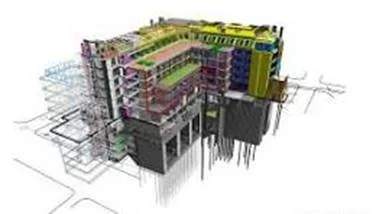
- The Next Generation of BIM & Digital Twins: BIM is no longer trapped in static design files or isolated software models. Today’s civil engineers and urban planners are linking open BIM schemas directly with live IoT sensor networks and GIS layers, creating operational digital twins that monitor structural health, optimize grid energy loads, and manage municipal traffic in real time.
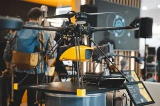
- UAVs & Autonomous Surveying: The crowd at the drone pavilions is making one thing clear: nobody is buying hardware just for flight specs anymore. The real demand is for automated ‘drone-in-a-box’ systems – docking stations running autonomous BVLOS (Beyond Visual Line of Sights) flight plans, instant battery recharges, and direct field-to-cloud mapping workflows without needing an operator on site.

What to Expect on the Floor
If anyone has ever spent three days pacing the floor at INTERGEO, they know how easy it is to walk through 500+ booths. But behind all the flashy hardware and booth pitch-decks, almost every workflow there comes down to one job: taking raw physical assets and turning them into readable, automated spatial data.

1.Advanced Data Capture:Day 1 Focus:
Compare the newest survey-grade hardware – from lightweight UAV LiDAR payloads to vehicle-mounted mobile mapping systems (MMS) capturing survey-grade point clouds at up to 80 km/h.
2.Automated Processing & AI Filtering:Day 2 Focus.
Get a hands-on look at the latest hardware on the floor, from sub-kilogram drone LiDAR to vehicle-mounted mobile mapping rigs that can scan an entire road network at traffic speed. Drop by the booth to compare specs or grab our floor map.
3.Integration & Actionable Digital Twins:Day 3 Focus.
Experience how that field data feeds straight into cloud GIS and BIM platforms, giving planners and engineers live updates on asset conditions without the usual processing lag.

The “Munich Bonus”
Setting INTERGEO 2026 at Messe München from September 15–17 isn’t just a win for surveying workflows – it puts the entire geospatial community in Munich right as Oktoberfest begins. If attendees are flying in to evaluate the latest 3D laser scanners, airborne LiDAR payloads, or RTK-GNSS tech, balancing packed exhibit halls with team networking is half the job. To save time on the floor, they compiled a quick 1-page breakdown of key exhibitor halls and after-hours networking spots.
The Industry Shift
If you are mapping out your trade show calendar, keep a close eye on INTERGEO’s evolving venue schedule. While Messe München hosts the show from September 15–17, 2026, the organizers are shifting to a restructured host model anchored heavily around Frankfurt starting in 2028, with rotating stops like Hamburg in alternate years. For surveying firms, LiDAR manufacturers, and GIS professionals evaluating high-end hardware integrations, understanding these venue rotations is crucial for long-term event budgeting and team logistics.
Whether end-users are looking to invest in a new fleet of autonomous sensors, trying to figure out how to fold AI into the current GIS workflows, INTERGEO 2026 is shaping up to be an unforgettable milestone for the industry.
The Final Implications
Whether end-users are looking to upgrade their firm’s survey gear with autonomous BVLOS drones, cut post-processing delays using edge AI, or just connect with peers in Munich, INTERGEO 2026 is where the industry is moving. The shift toward real-time digital twins and automated field-to-finish workflows is already here, and seeing these systems in action is the fastest way to figure out what’s actually worth bringing back to the team. Drop by the exhibit halls at Messe München this September 15–17, connect with the engineering teams on the floor, and grab event pass to secure a spot at the year’s premier spatial data summit.

Event awareness put together by:
25+ years of experience in the Geospatial Industry