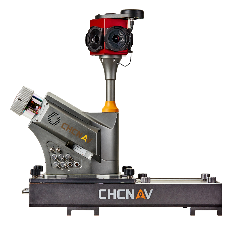
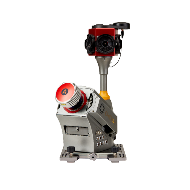
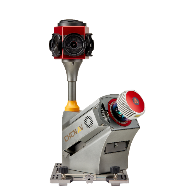
CHCNAV Alpha3D Mobile Mapping System
The Alpha3D Mobile Mapping Solution from CHC Navigation is a high-performance, vehicle-independent system designed for capturing mass geospatial data. It combines an advanced long-range, high-speed laser scanner, a high-resolution HDR panoramic camera, a cutting-edge GNSS receiver, and a high-precision IMU, all within a compact and robust instrument. This integration makes the Alpha3D one of the most advanced and efficient 3D mobile mapping systems available.
Key Features:
High-Performance Laser Scanner:
- Scans at an ultra-fast rate of 1.8 million points per second with a long-range capability up to 475 meters.
High-Resolution 360° Imaging:
- Features a 30 MP HDR panoramic camera that provides superior image quality.
Vehicle Independence:
- Easily mounts on a variety of vehicles, including cars, trains, railway trolleys, and boats.
Versatile Data Collection:
- Capable of integrating additional sensors such as high-resolution cameras, thermal cameras, GPR, echo-sounders, and more.
Enhanced Productivity and ROI:
- Rapid and accurate data collection reduces project completion times and minimizes the need for return site visits.
CoCapture Software:
- Intuitive, browser-based operation for mission management and data capture using any Android device.
The Alpha3D is a state-of-the-art mobile mapping solution that offers geospatial professionals a powerful and flexible tool for capturing detailed and accurate 3D data. With its high-speed laser scanning and high-resolution imaging capabilities, the Alpha3D ensures that projects are completed faster and with greater accuracy, thereby increasing return on investment. The system’s ability to mount on various types of vehicles and its support for additional sensors make it a versatile solution for a wide range of mapping and geospatial applications.
Application:
The Alpha3D is ideally suited for a wide range of applications, including urban mapping, transportation infrastructure monitoring, environmental surveys, and more. Its ability to rapidly and accurately collect high-density point clouds and detailed imagery makes it invaluable for projects requiring precise and comprehensive geospatial data. Whether mounted on a car for city mapping, a train for railway inspection, or a boat for hydrographic surveys, the Alpha3D enhances efficiency and productivity, providing geospatial professionals with the data they need to make informed decisions and deliver high-quality results.


Reviews
There are no reviews yet.