
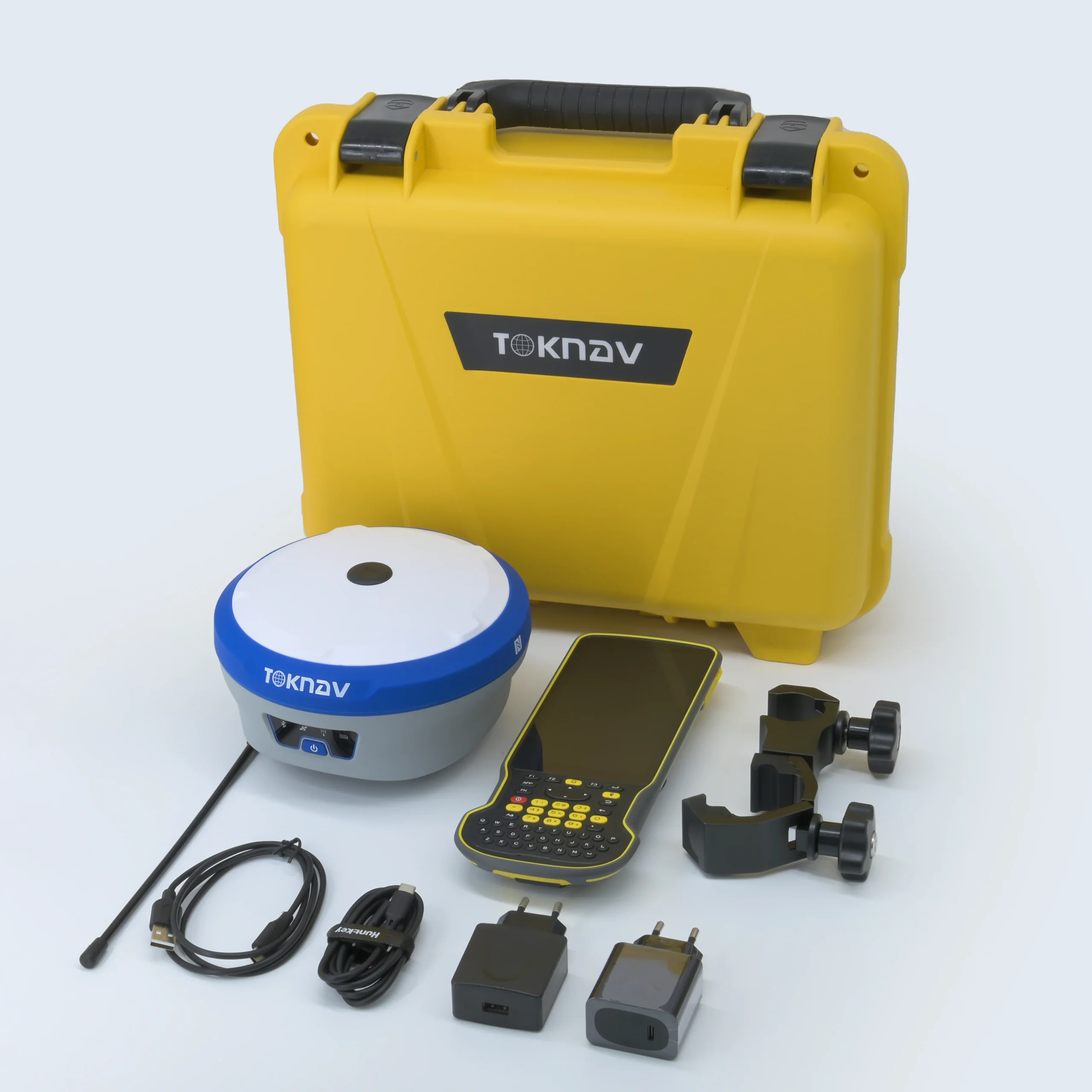
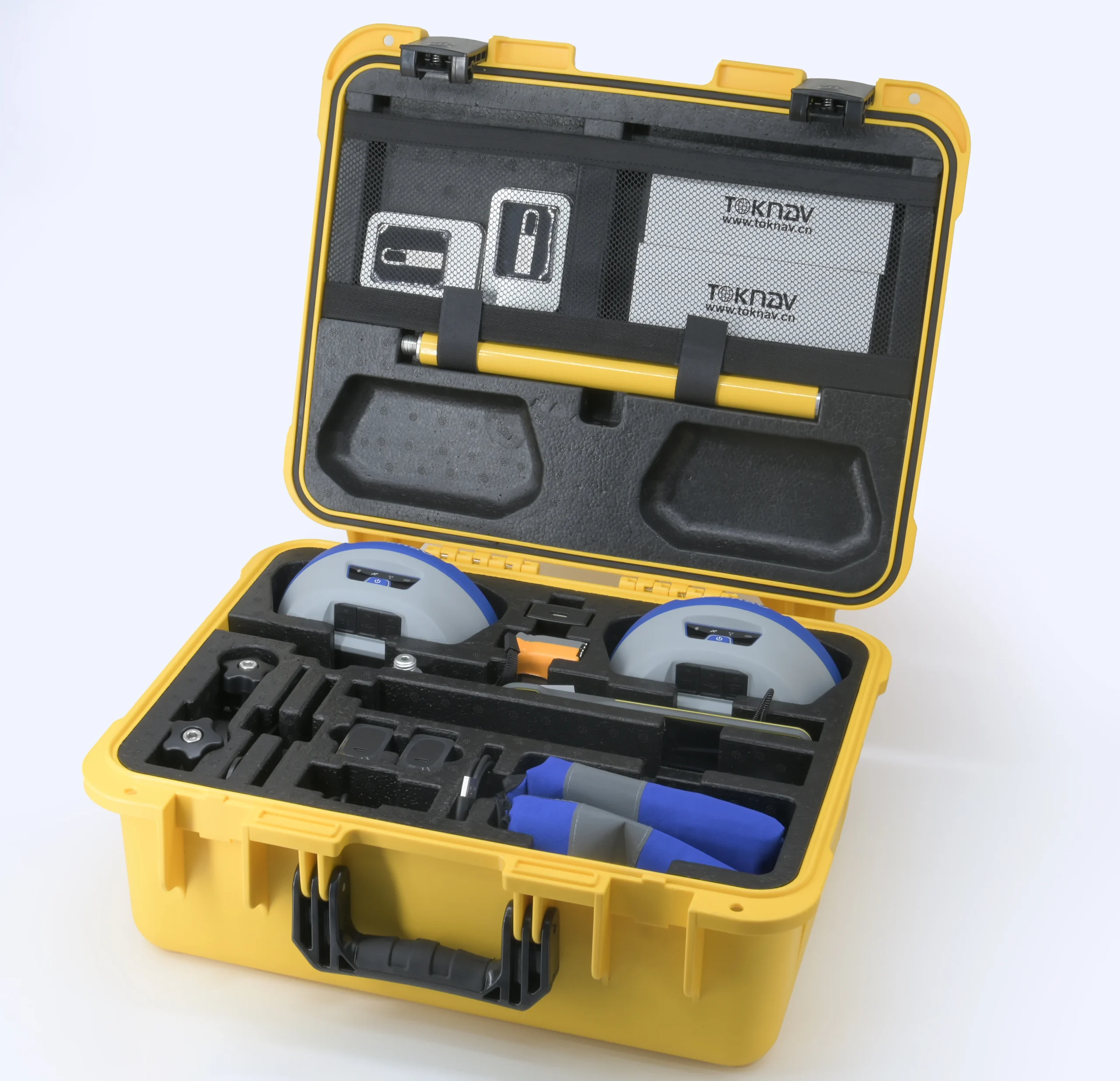
Toknav T30 GNSS Receiver – Precision Redefined for Professional Surveying
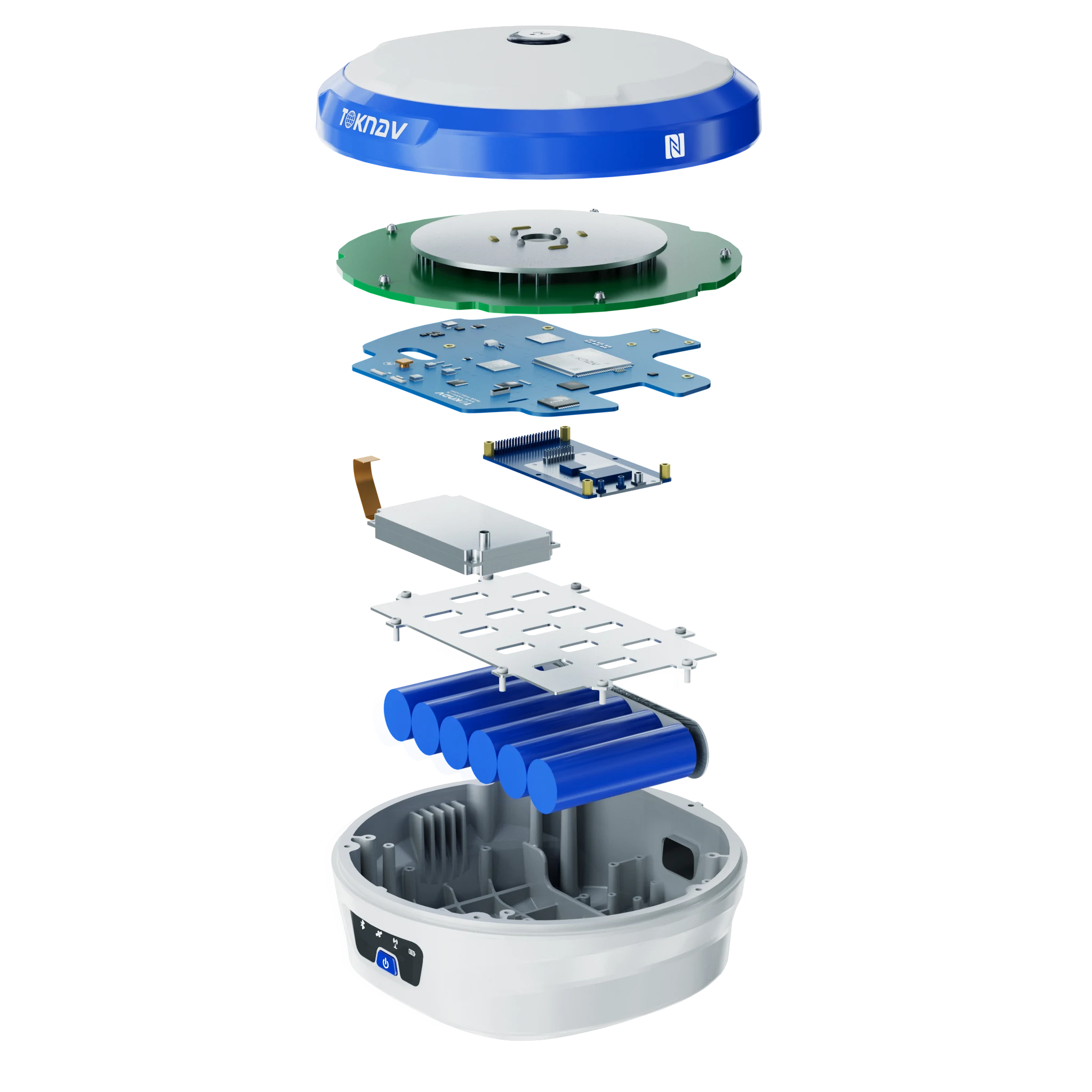
The Toknav T30 GNSS Receiver is a state-of-the-art positioning solution engineered for exceptional accuracy and efficiency. Designed with a Linux-based intelligent system and powered by the ARM Cortex-A7 processor, the T30 delivers full-system GNSS reception across multiple frequencies, enabling precise geospatial measurements in real time. With 4G universal connectivity, 5W data radio, and an integrated laser measurement module, it brings enhanced field capabilities to professionals in surveying, construction, and GIS mapping. Its robust magnesium alloy construction, coupled with IP68 protection, ensures optimal performance even in extreme conditions. The 13800mAh high-capacity battery supports over 48 hours of continuous operation, making it a reliable companion for extensive fieldwork.
Key Features of Toknav T30 GNSS Receiver
Full-System GNSS Support: Tracks GPS, GLONASS, BDS, GALILEO, QZSS, SBAS, and NavIC signals for robust global coverage.
Extended Battery Life: Equipped with a 13800mAh battery, providing over 48 hours of uninterrupted operation.
High-Precision Inertial Navigation: Advanced IMU technology for tilt compensation up to 60°.
4G Universal Connectivity: Supports 2G, 3G, and 4G networks for seamless data communication.
Quick Reacquisition & Fast Cold Start: Achieves a cold start in under 40s and reacquisition in less than 1s.
Rugged Design: Built with magnesium alloy and an ABS/PC top cover, rated IP68 for maximum durability.
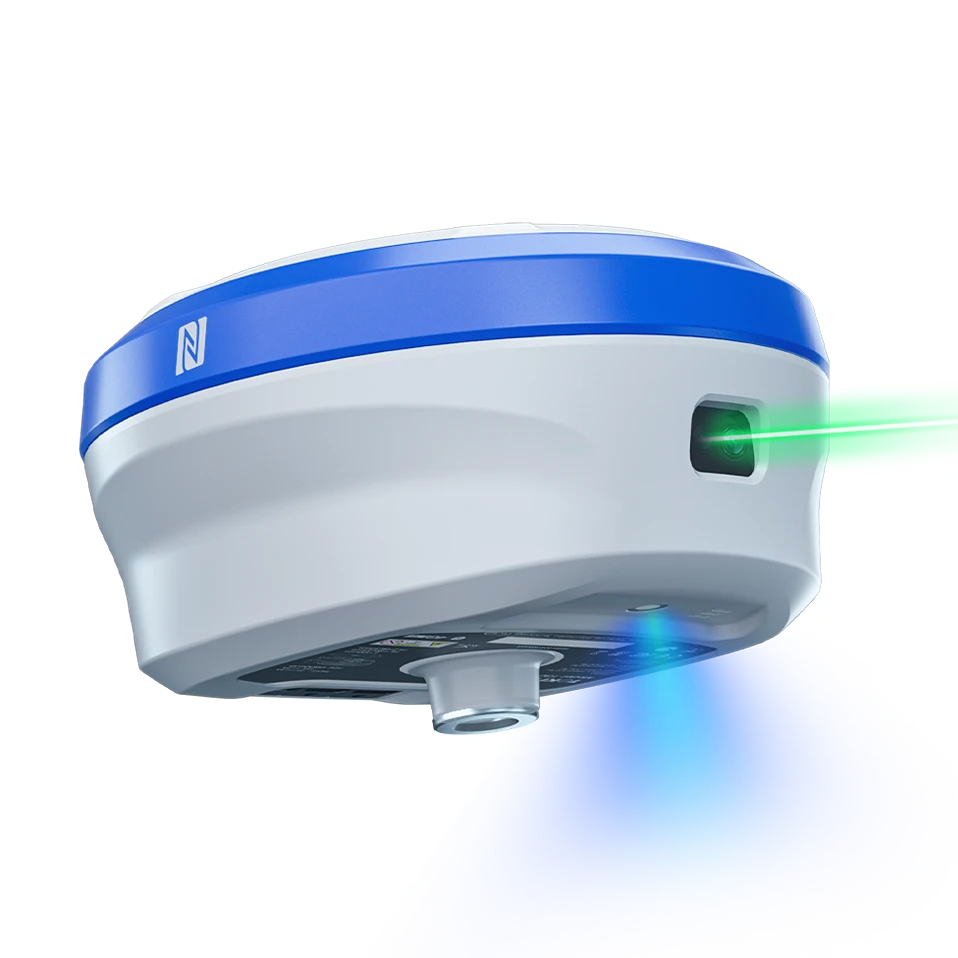
Laser Measurement Technology: Integrated millimeter-level laser ranging for precise measurements in complex environments.
AR Real-Time Stakeout: High-definition ultra-wide-angle camera for accurate and intuitive staking.
Data Radio & Communication: 5W high-power transceiver with support for TRIMTALK, TRIMMK3, SOUTH, and TRANSEOT protocols.
Applications of the Toknav T30 GNSS Receiver
Land Surveying: Achieve sub-centimeter accuracy for boundary marking and topographic surveys.
Construction Layout: AR real-time staking streamlines construction layout tasks with high precision.
GIS Mapping: Capture geospatial data for urban planning, resource management, and infrastructure development.
Utility Mapping: Identify and document underground utilities and electrical grids with pinpoint accuracy.
Agriculture Mapping: Optimize field planning and boundary assessments with precise GNSS data.
Environmental Monitoring: Collect accurate geographic data for land conservation and environmental studies.


Reviews
There are no reviews yet.