Toknav T40 GNSS Receiver – Dual-Laser Camera RTK with AR Stakeout and Visualized Laser Measurement
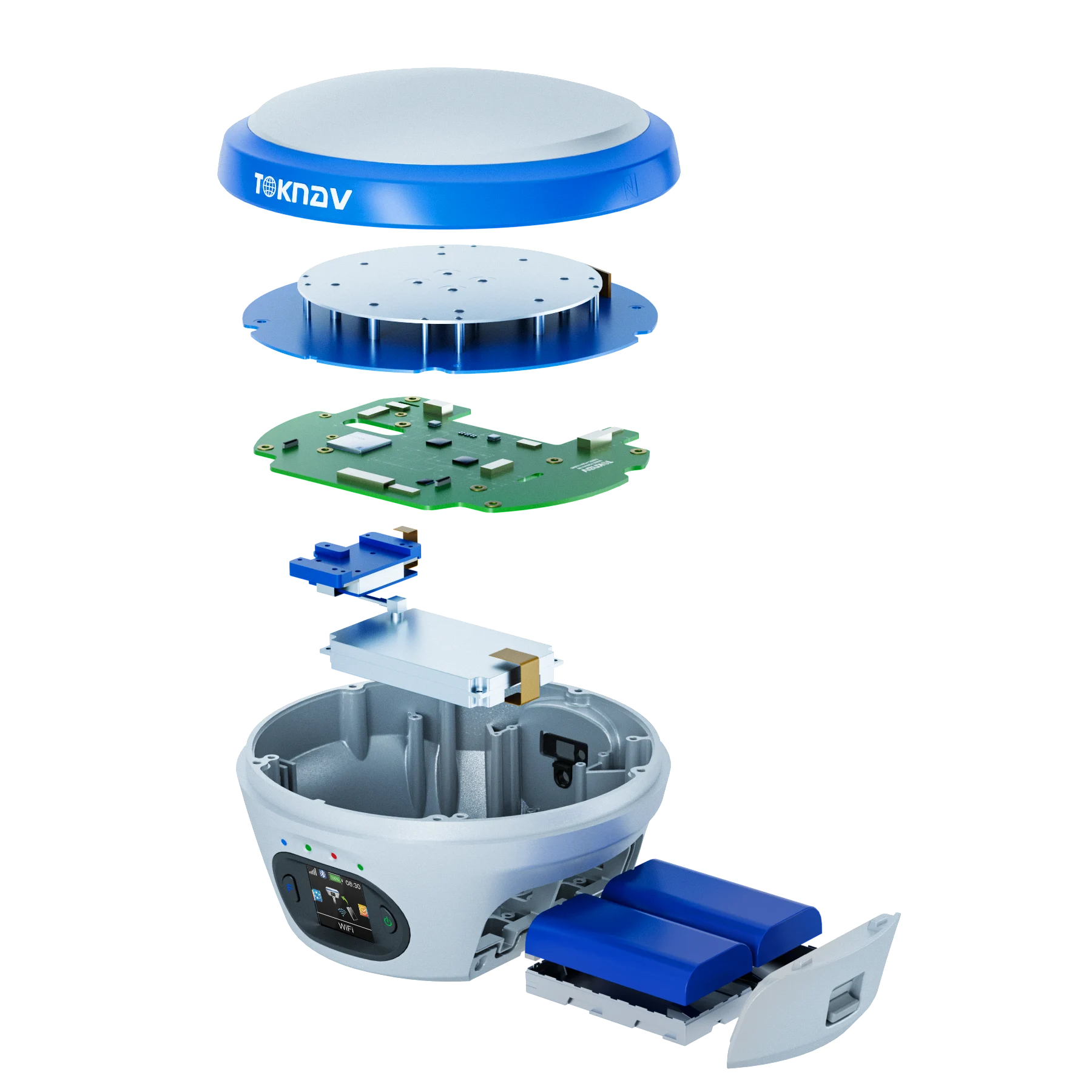
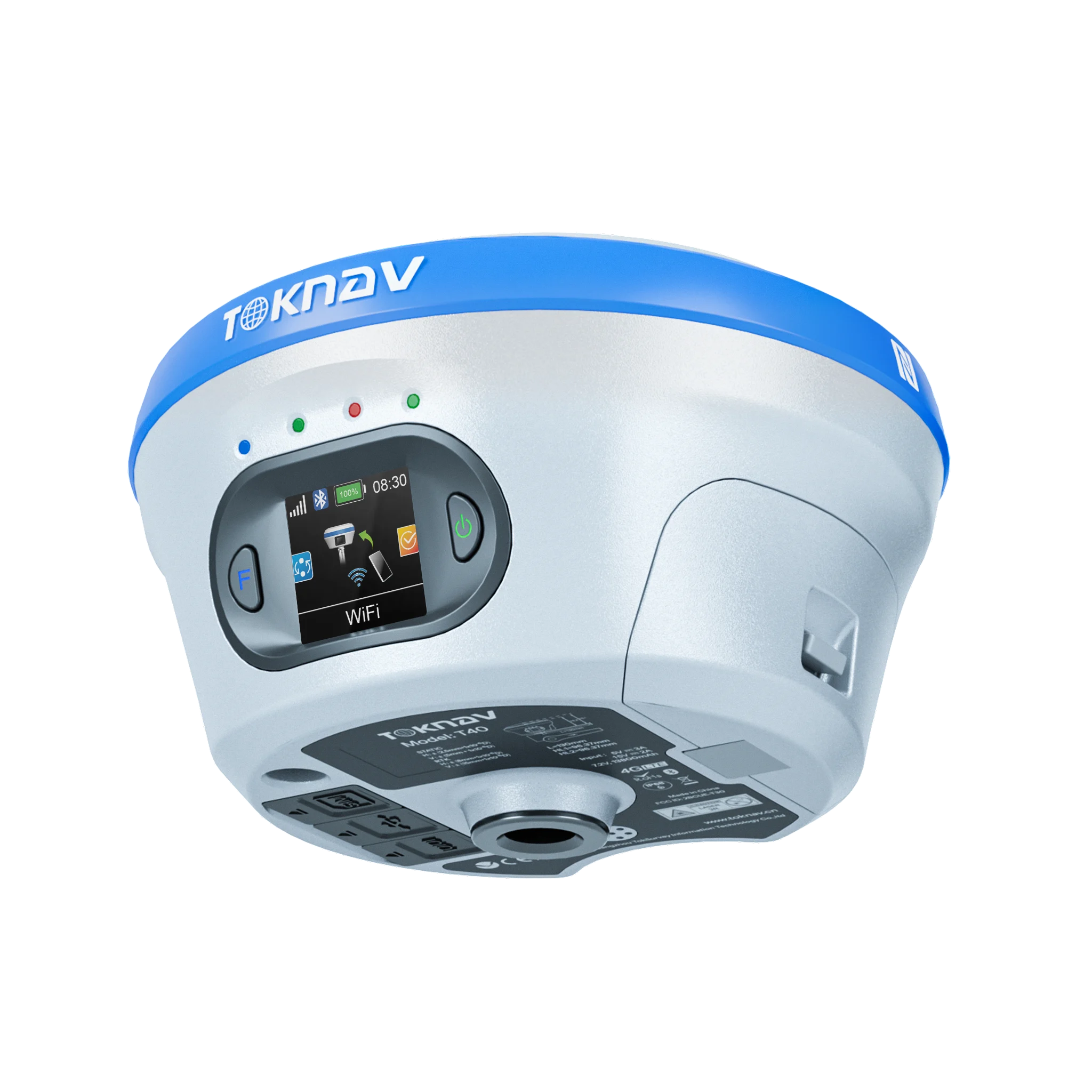
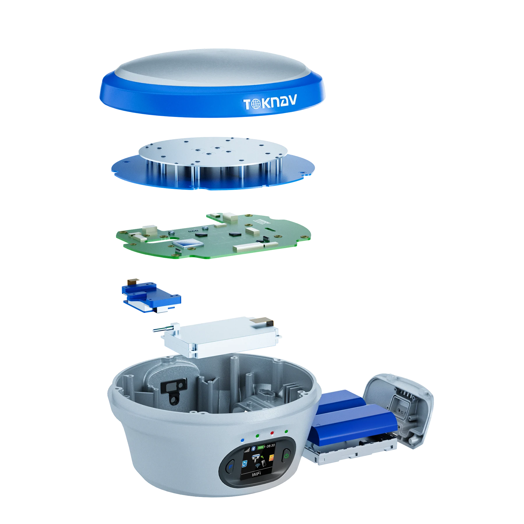
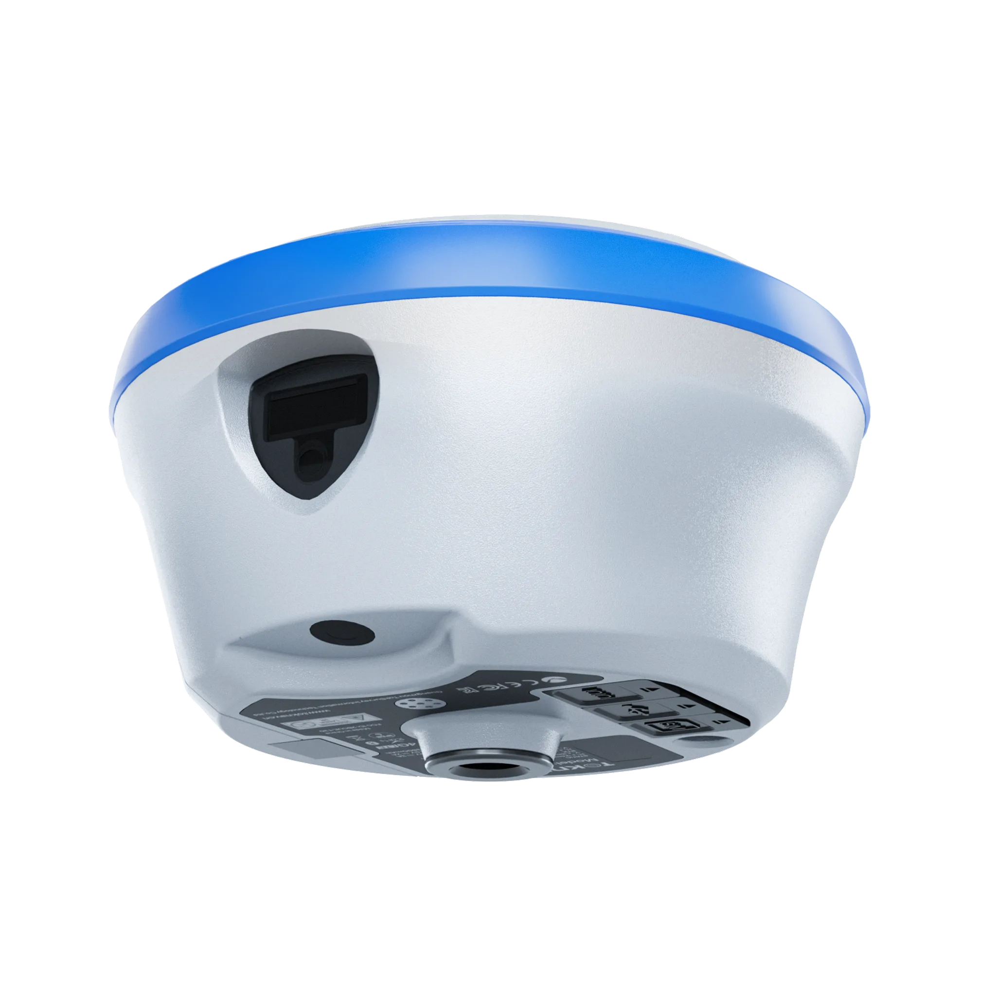
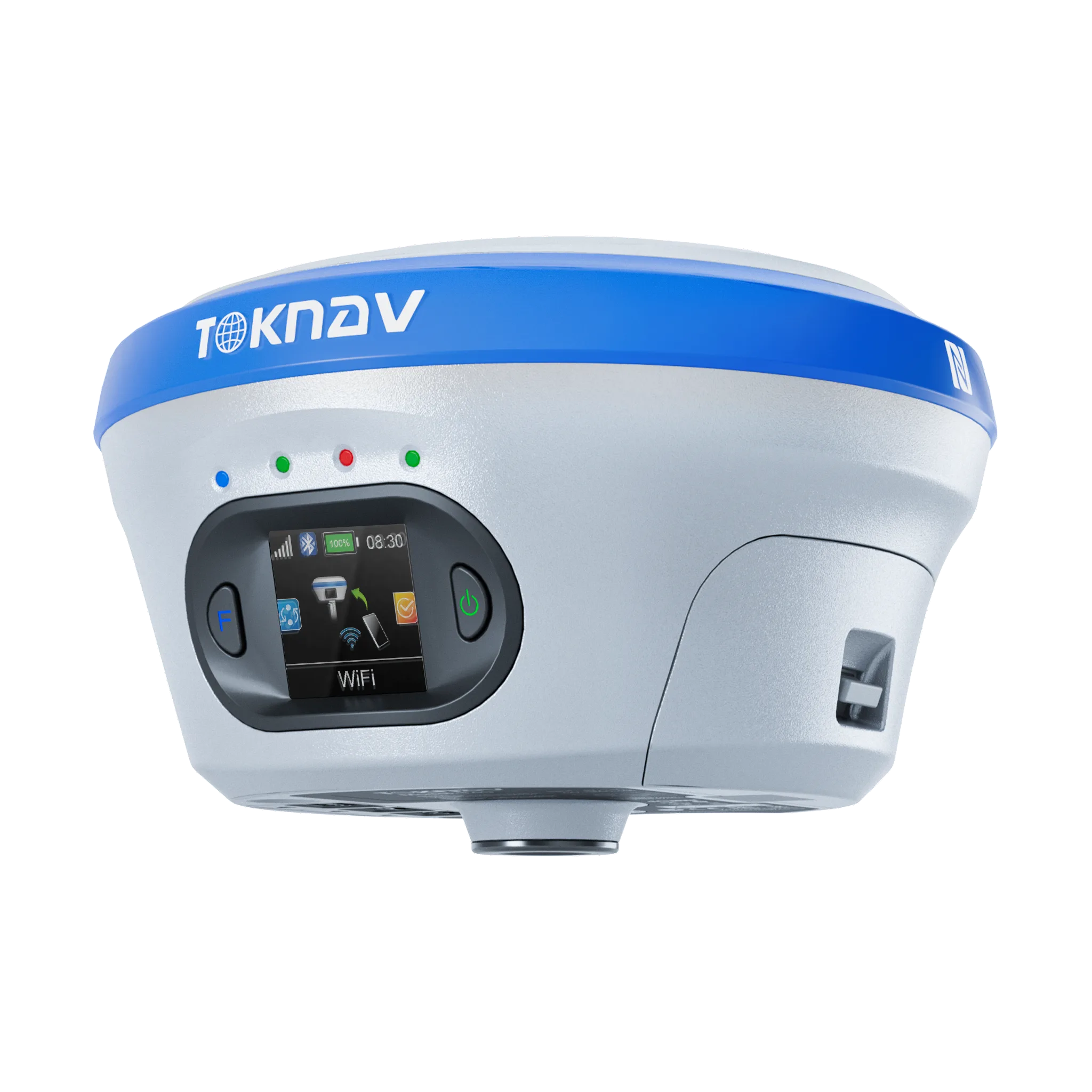
The Toknav T40 GNSS Receiver from Toknav is an advanced, multi-functional GNSS solution designed for high-precision surveying, construction, and geospatial mapping. Equipped with dual-laser cameras, IMU, AR technology, and laser visualization, the T40 enables real-time tilt measurement, AR-based stakeout, and millimeter-precision laser point measurement up to 30 meters. Its rugged magnesium-aluminum alloy body ensures durability in harsh environments, while the hot-swappable battery system provides extended operation without interruptions. The T40 sets new standards for efficiency and accuracy in field applications, making it an ideal choice for professionals who demand reliability and precision.
Key Features of Toknav T40Pro GNSS Receiver
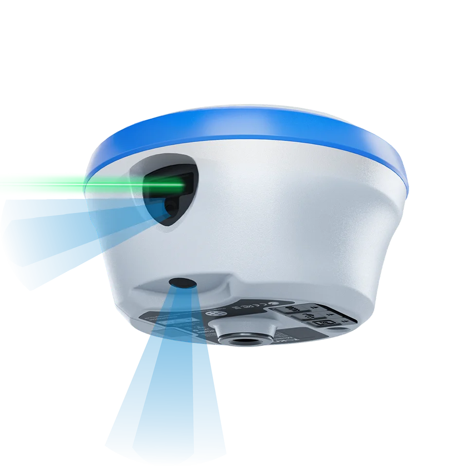
Dual-Laser Camera Technology: Equipped with high-definition laser cameras that allow visualized laser point measurement with ±5mm accuracy up to 30m.
Tilt Measurement with IMU: Achieve precise tilt compensation with its intelligent inertial navigation system, eliminating “floating points” during RTK surveys.
AR Stakeout: Real-world, ultra-wide-angle AR staking ensures precise, one-shot staking even in complex environments.
Hot-Swappable Batteries: Two detachable 3400mAh batteries provide over 20 hours of uninterrupted field operation.
Rugged Magnesium-Alloy Design: Built to withstand harsh conditions with IP68-rated protection and a drop resistance of 1.5m.
Multi-Constellation Support: Compatible with GPS, GLONASS, BDS, GALILEO, QZSS, SBAS, and NavIC, ensuring high-precision global coverage.
Linux-Based Intelligent System: Powered by an ARM Cortex-A7 processor, it offers seamless multi-frequency GNSS reception and faster data processing.
Laser Visualization: Provides real-time laser point data visualization for accurate measurement and enhanced fieldwork accuracy.
Applications of the Toknav T40Pro GNSS Receiver
Land Surveying – Achieve sub-centimeter accuracy even in tilted or obstructed environments.
Construction Layout – Perform real-time AR-based stakeout for faster and more precise layout marking.
Laser Measurement & Mapping – Visualized laser point measurement ensures millimeter precision up to 30m.
Utility Mapping – Capture and map utilities like pipelines and cables with absolute precision.
Geospatial Data Collection – Gather high-precision GNSS data for GIS and mapping projects with confidence.
Industrial Site Surveys – Map industrial facilities, boundary lines, and infrastructure with enhanced accuracy.


Reviews
There are no reviews yet.