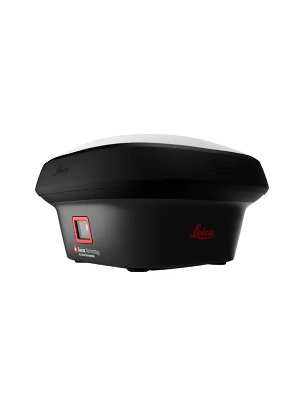
Leica GS18 I GNSS RTK Rover with Visual Positioning
- Measure points with obstructed view to the sky more efficiently and easily.
- Capture points you couldn’t reach before with a GNSS rover.
- Gain more flexibility and control, with no need to use additional time-consuming equipment.
- Map hundreds of points with survey-grade accuracy within minutes.
- Tap on an image to measure a point in the field or in the office.
- Quick and thorough so you catch every detail
Introducing Leica GS18 I, a versatile, survey-grade GNSS RTK rover with Visual Positioning. Designed for surveying professionals to measure points which previously could not be measured with a GNSS rover easily and accurately. Now, you can quickly capture the site in images and measure points from them, either in the field or later in the office. For GS18, I means imaging.Sensor fusion of GNSS, IMU and a camera come together to create Visual Positioning technology, resulting in a GNSS RTK rover so powerful that it enables you to measure what you see. GS18 I has all the functionality of the Leica GS18 T: in addition to Visual Positioning, users can for example map points with either tilted or levelled pole.
Measure points with obstructed view to the sky more efficiently and easily.
Capture points you couldn’t reach before with a GNSS rover.
Gain more flexibility and control, with no need to use additional time-consuming equipment.
Map hundreds of points with survey-grade accuracy within minutes.
Capture the scene quickly and decide later, what should be measured – even if the scene subsequently changes or disappears.
Tap on an image to measure a point in the field or in the office.
Quick and thorough so you catch every detail.
- 1.Measure points with obstructed view to the sky more efficiently and easily.
- 2.Capture points you couldn’t reach before with a GNSS rover.
- 3.Gain more flexibility and control, with no need to use additional time-consuming equipment.
- 4.Map hundreds of points with survey-grade accuracy within minutes.
- 5.Tap on an image to measure a point in the field or in the office.
- 6.Quick and thorough so you catch every detail
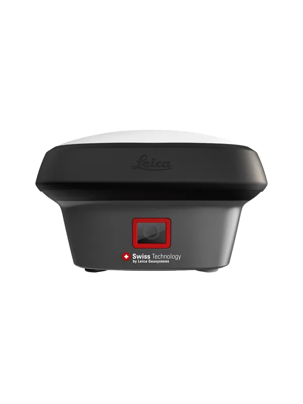
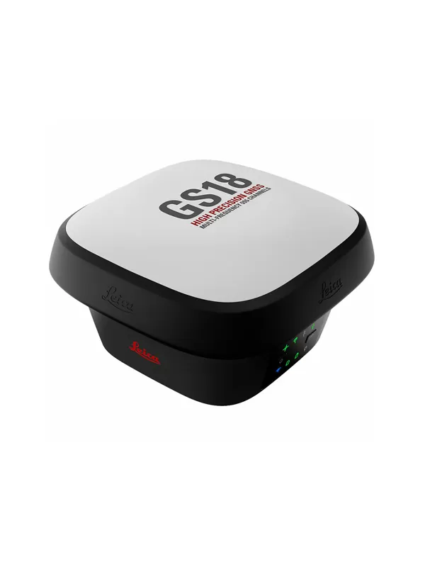
Leica GS18 I
GNSS TECHNOLOGY
Self-learning GNSS Leica RTKplus
SmartLink (worldwide correction service)
SmartLink fill (worldwide correction service)
Adaptive on-the-fly satellite selection
Remote precise point positioning (3 cm 2D)1, Initial convergence to full
accuracy typically 18 min, Re-convergence < 1 min
Bridging of RTK outages up to 10 min (3 cm 2D) 1
Leica SmartCheck Continuous check of RTK solution Reliability 99.99%
Signal tracking GPS | GLONASS
Galileo | BeiDou
L1, L2, L2C, L5 | L1, L2, L2C, L3
E1, E5a, E5b, AltBOC, E6 | B1I, B1C, B2I, B2a, B3I
QZSS | NavIC L1, L2C, L5, L62 | L53
SBAS | L-Band WAAS, EGNOS, MSAS, GAGAN | TerraStar
RAIM Receiver Autonomous Integrity Monitoring Detection and elimination of faulty satellite signals
Number of channels 555 (more signals, fast acquisition, high sensitivity)
Tilt compensation Increased measurement productivity
and traceability
Calibration-free
Immune to magnetic disturbances
IMAGING
Measuring camera Sensor | Field of view | Video frame rate Global shutter with 1.2 MP | Hz 80°, V 60° | 20 Hz
Image group capture 2 Hz capturing rate Max. capturing time: 60 s, size of an image group appr. 50 MB
Point cloud Leica Infinity software Derive point clouds from image groups
MEASUREMENT PERFORMANCE & ACCURACY1
Time for initialisation Typically 4 s
Real-time kinematic
(Compliant to ISO17123-8 standard)
Single baseline
Network RTK
Hz 8 mm + 1 ppm | V 15 mm + 1 ppm
Hz 8 mm + 0.5 ppm | V 15 mm + 0.5 ppm
Real-time kinematic tilt compensated Not for static control points Additional Hz uncertainty max 8 mm + 0.4 mm/° tilt down to 30° tilt
Post processing Static (phase) with long observations
Static and rapid static (phase)
Hz 3 mm + 0.1 ppm | V 3.5 mm + 0.4 ppm
Hz 3 mm + 0.5 ppm | V 5 mm + 0.5 ppm
Code differential DGNSS Hz 25 cm | V 50 cm
Image point measurement 1-click measurement in field & office Typically 2 cm – 4 cm (2D1) within the distance of 2 m to 10 m to the
object
COMMUNICATIONS
Communication ports Lemo | Bluetooth® | WLAN USB and RS232 serial | Bluetooth® v4.0 (BLE & BR/EDR), class 1.5 |
802.11 b/g/n for field controller communication only
Communication protocols RTK data protocols
NMEA output
Network RTK
Leica 4G, Leica, CMR, CMR+, RTCM 2.2, 2.3., 3.0, 3.1, 3.2 MSM
NMEA 0183 v4.00 & v4.10 and Leica proprietary
VRS, FKP, iMAX, MAC (RTCM SC 104)
Built-in 4G LTE modem4 LTE frequency bands
UMTS frequency bands
GSM frequency bands
20, 8, 3, 1, 7 | 13, 17, 5, 4, 2 | 19, 3, 1
8, 3, 1 | 5, 4, 2 | 6, 19, 1
900, 1800 | 850, 900, 1800, 1900 MHz
Built-in UHF modem5 Receive & transmit UHF radio modem 403 – 473 MHz, channel spacing 12.5 kHz, 20 kHz, 25 kHz, max. 1 W output power up to 28800 bps over air | 902 – 928 MHz (licence free in North
America), max 1 W output power
GENERAL
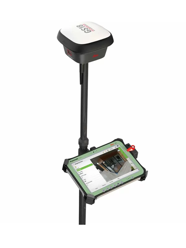
Field controller and software Leica Captivate software Leica CS20 LTE or BASIC field controller, Leica CS30 & CS35 tablets
User interface Buttons and LEDs
Web server
On / Off and Function button, 8 status LEDs
Full status information and configuration options
Data recording Storage
Data type and recording rate
Internal memory up to 4 GB, Removable SD card
Leica GNSS raw data and RINEX data at up to 20 Hz
Power management Internal power supply
External power supply
Operating time6
Exchangeable Li-Ion battery (2.8 Ah / 11.1 V)
Nominal 12 V DC, range 10.5 – 26.4 V DC
Typical time up to 8 h
Weight and dimensions Weight | Dimensions 1.25 kg / 3.55 kg standard RTK rover setup on pole | 173 mm x 173 mm x 109 mm
Environmental Temperature
Drop
Proof against water, sand and dust
Vibration
Humidity
Functional shock
-30 to +50°C operating with camera, -40 to +65°C operating
without camera, -40 to +85°C storage
Withstands topple over from a 2 m survey pole onto hard surfaces
IP66 | IP68 (IEC60529 | MIL STD 810G CHG-1 510.6 I |
MIL STD 810G CHG-1 506.6 II, MIL STD 810G CHG-1 512.6 I)
Withstands strong vibration (ISO9022-36-08 | MIL STD 810G 514.6 Cat.24)