TOPCON HiPer VR
- Universal tracking technology for all satellites and constellations (GPS, GLONASS, Galileo, Beidou, IRNSS, QZSS, SBAS) covering all modernized signals
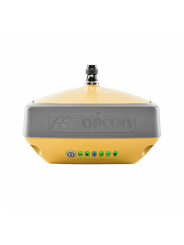
- Field tested, field ready IP67 design
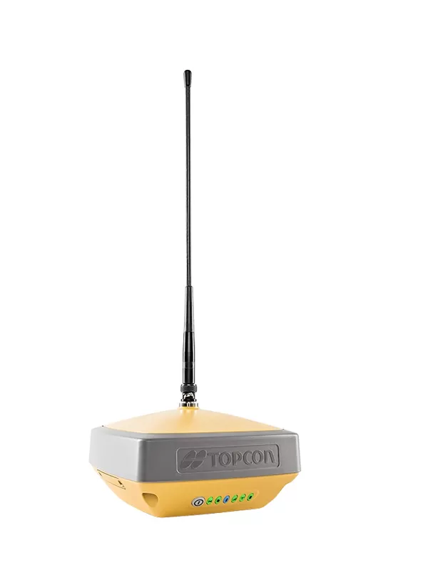
- Compact form factor ideal for Millimeter GPS and Hybrid Positioning
- Revolutionary 9-axis IMU and ultra-compact 3-axis eCompass
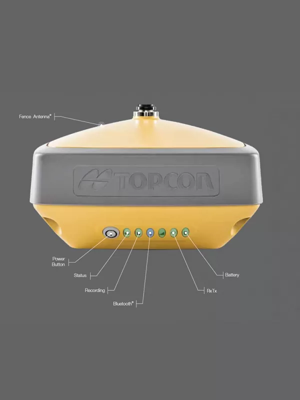
- Integrated 400 MHz UHF Tx/Rx Radio Modem
- Integrated License free 900 MHz Radio Modem, FH915 protocol
Versatile Performance
Better things in smaller packages!
The HiPer VR* is compact, light and packed with the most advanced GNSS technology in a design built to withstand the harshest field environments. Using Topcon’s advanced GNSS chipset with Universal Tracking Channels Technology, the HiPer VR automatically tracks every satellite signal above – now and into the future.
All signals, all satellites and all constellations — in a compact, rugged design, with an integrated IMU and eCompass.
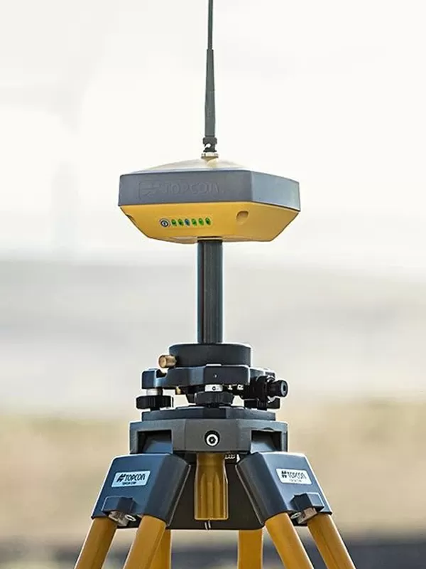
The HiPer VR is a complete solution and versatile in many ways. It can be used for static or kinematic GNSS post-processed surveys, as a network RTK rover with the FC-5000's internal 4G/LTE cellular modem, as a UHF/FH/Longlink jobsite RTK rover, and also in Topcon’s patented Hybrid Positioning workflow.
- Universal tracking technology for all satellites and constellations (GPS, GLONASS, Galileo, Beidou, IRNSS, QZSS, SBAS) covering all modernized signals
- Field tested, field ready IP67 design
- Compact form factor ideal for Millimeter GPS and Hybrid Positioning
- Revolutionary 9-axis IMU and ultra-compact 3-axis eCompass
- Integrated 400 MHz UHF Tx/Rx Radio Modem
- Integrated License free 900 MHz Radio Modem, FH915 protocol
L1 C/A, L1C* L2C, L2P(Y), L5
L1 C/A, L1P, L2C/A, L2P, L3C*
E1/E5a/E5b/Alt-BOC
B1, B2
L5
WAAS, EGNOS, MSAS, GAGAN (L1/L5§)
TopNET Global D & C Corrections services
L1 C/A, L1C, L1-SAIF, L2C, L5
V: 5 mm + 0.5 ppm
V: 10 mm + 0.8 ppm
Tilt ? 10°
H: 1.8 mm/°Tilt;
Tilt > 10°
TX mode 1W - 6hr
Max Transmit Power: 1W
Range: 5-7 km typical; 15 km
(w x h x d)