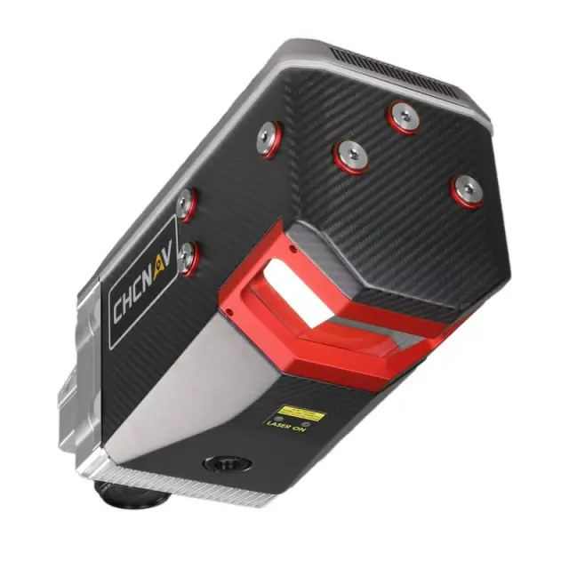


CHCNAV AlphaAir 2400 Multi-Platform LiDAR Solution
The AlphaAir 2400 (AA2400) is a premium airborne laser scanner from CHCNAV designed for high-altitude LiDAR mapping. It features a Riegl VUX-240 scanner with a 2150-meter range, allowing for extensive surveying missions up to 1400 meters in altitude. With its high-speed data acquisition rate and precision GNSS/IMU integration, the AA2400 is ideal for large corridor mapping projects using helicopters, airplanes, or UAVs.
Key Features:
Data Acquisition at High Altitude:
- Survey-grade accuracy of 20 mm.
- Operating flight altitude up to 1400 m.
- Scanning range up to 2150 m with 2 cm linear accuracy.
Professional Imaging Sensors:
- Supports up to four external cameras.
- High-resolution imagery (100-150 MP) from PhaseOne cameras.
Extreme Productivity and Data Quality:
- High-speed data acquisition up to 1.8 MHz.
- Scan speeds up to 400 lines per second.
Easy Installation and Operation:
- Cable-free connection and wireless control.
- Embedded remote control system with an 8 km range.
Comprehensive Ecosystem:
- CoCapture UAV software for automated reality capture.
- CoPre desktop software for point cloud processing.
The AlphaAir 2400 offers a blend of low weight, extended range, and high accuracy, making it suitable for high-altitude LiDAR missions. It integrates the Riegl VUX-240 scanner, which minimizes laser shadowing and captures complex vertical structures. The AA2400 can be easily installed on various airborne platforms, providing detailed and accurate data for a range of geospatial applications.


Reviews
There are no reviews yet.