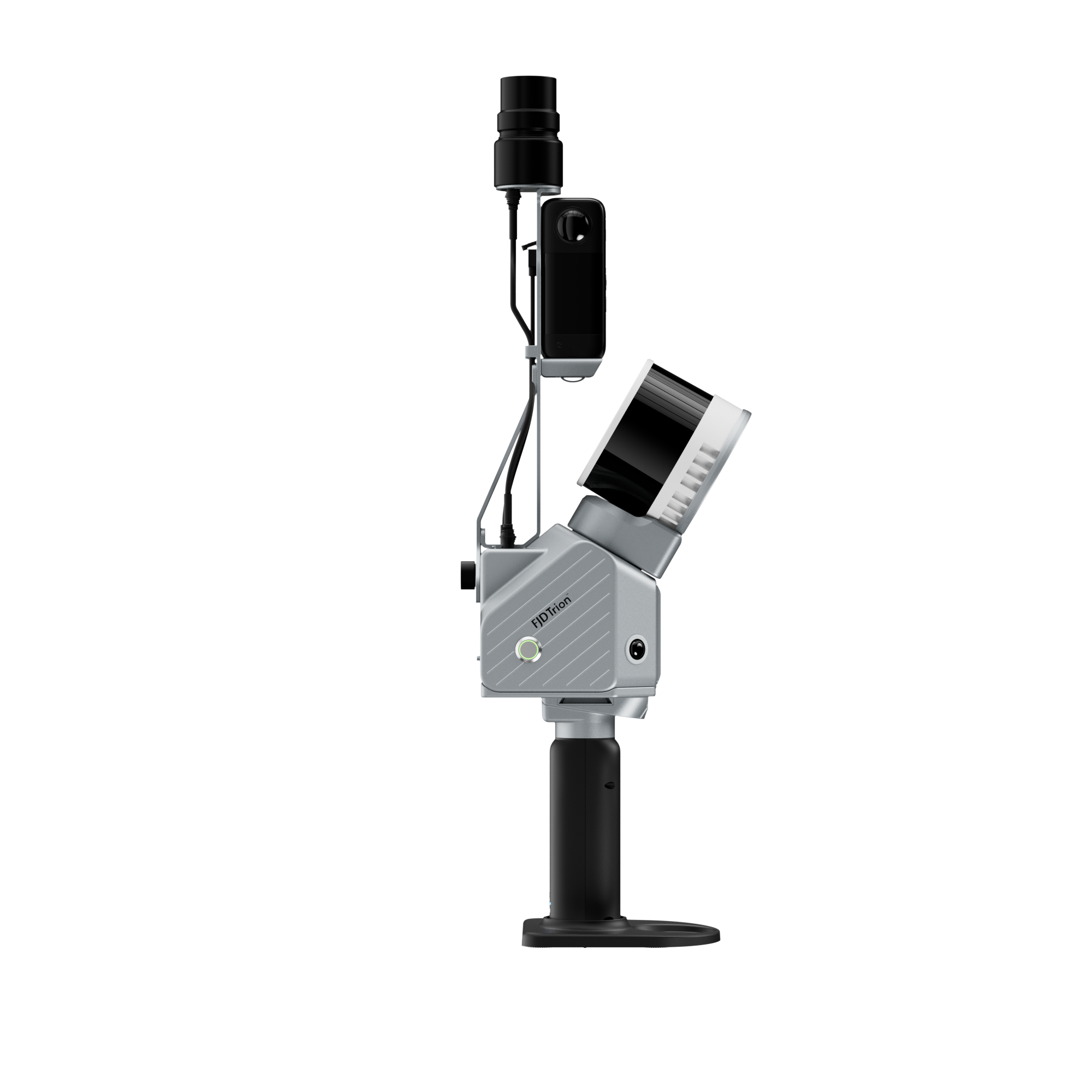

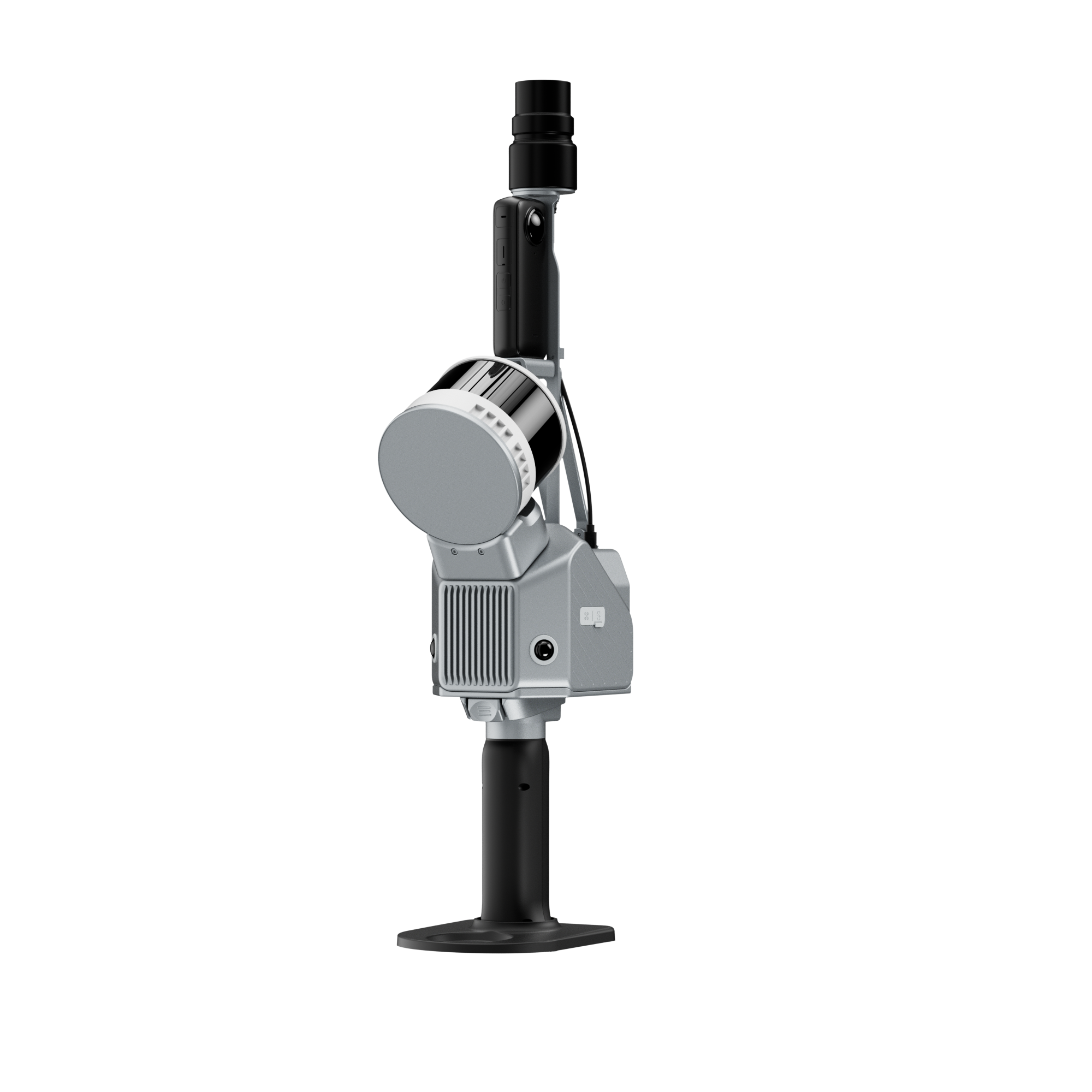
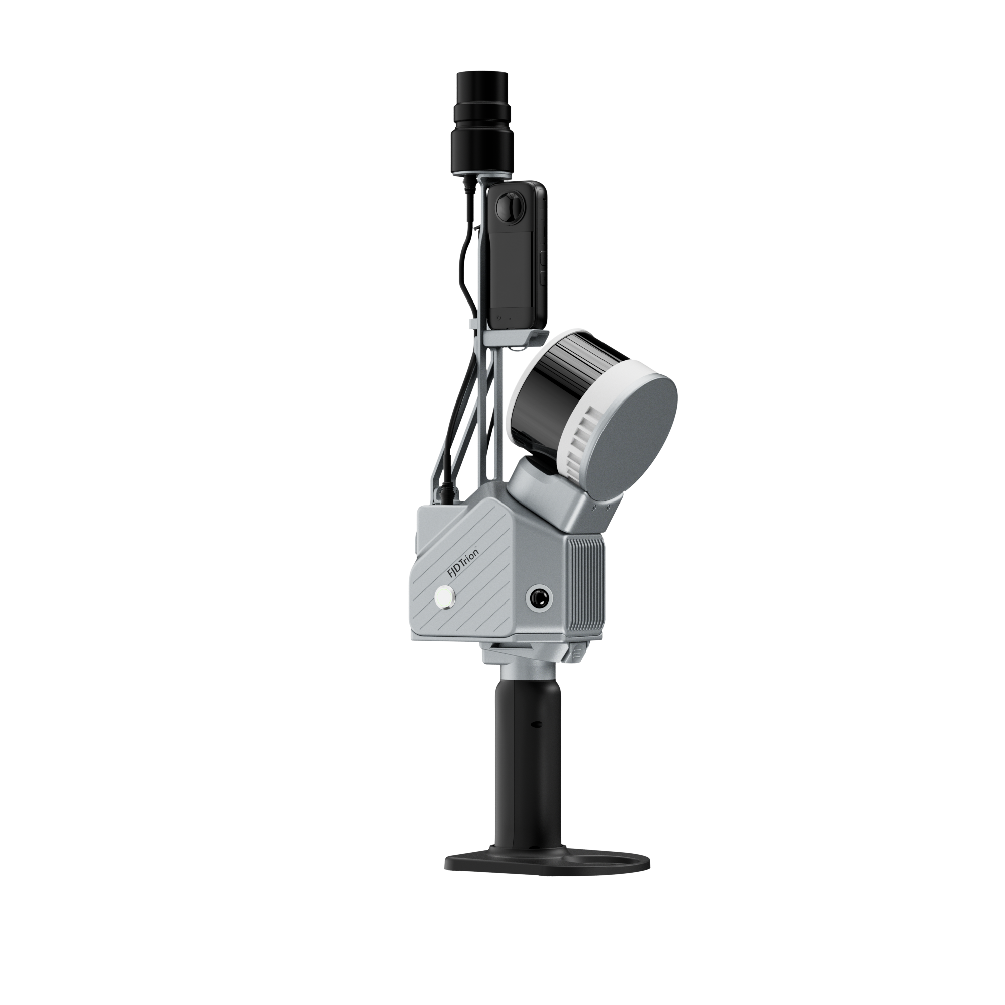


FJD Trion S2 Series Handheld LiDAR Scanner
The Trion S2 series is a family of high-performance, handheld/portable LiDAR-based 3D scanning devices from FJDynamics. They combine LiDAR, IMU, high-resolution cameras, and optional GNSS/RTK positioning into a compact scanner, enabling efficient, high-accuracy point-cloud capture for surveying, mapping, as-built documentation, BIM/CAD workflows, and more.
The S2 family includes multiple configurations (S2, S2 Pro, S2 Max), offering flexibility for different application requirements — from standard building or infrastructure surveys to large-scale topographical or mining environments.
Key Features of FJD Trion S2 Series Handheld LiDAR Scanner
-
High scanning performance & range — up to 120 m range (80% reflectivity) on S2/S2 Pro; up to 300 m for S2 Max.
-
High-density point clouds — up to 320,000 points/sec (S2) or 640,000 pts/s (S2 Pro / S2 Max) for dense, detailed scans.
-
Wide field of view — 360° horizontal × 270° vertical, covering full surroundings in a single scan, reducing blind spots.
-
Integrated RTK & GNSS support — georeferenced point clouds with real-time positioning; supports multiple satellite constellations.
-
Dual 12 MP cameras + SLAM/VIO — enables real-time colorized point clouds, visual-inertial odometry for robust performance even in low-feature environments.
-
Portable and field-ready — scanner weight ~1.8 kg (excluding batteries/RTK modules), compact form factor (≈ 107×118×398 mm), suitable for handheld, backpack, pole, drone, or vehicle-mounted use.
-
Flexible workflow — onboard storage (512 GB, expandable to 1 TB), Wi-Fi / USB export, and compatibility with common point-cloud formats (.las, .ply, .pts, .e57) for easy integration with CAD/BIM/GIS tools.
Typical Applications
-
Surveying & Topography — terrain mapping, site as-built surveys, contour and land surveys.
-
Architecture / BIM / Construction — building scans, structural inspections, as-built documentation, renovation planning.
-
Infrastructure & Civil Works — road, bridge, tunnel, or pipeline surveys; volumetric calculations; deformation monitoring.
-
Mining / Quarry / Industrial — large-scale environment scanning, stockpile measurement, underground and open-pit geometry mapping.
-
Forestry & Vegetation Analysis — canopy measurement, biomass estimation, terrain-vegetation mapping.
-
Public Safety & Forensics — accident or crime scene documentation, disaster assessment, rescue planning.
Why S2 Over Other Models
-
Scalable performance: Depending on project scale, you can choose S2 (standard), S2 Pro, or S2 Max — from building-scale to large-area terrain or mining surveys.
-
High data density & accuracy: Up to 640 k pts/s and cm-level accuracy gives detailed, usable point clouds even for demanding use-cases.
-
Lightweight & portable: At ~1.8 kg, it remains field-convenient, yet powerful.
-
Integrated GNSS/RTK and SLAM: Minimizes need for external control points, reduces post-processing time, and speeds up georeferenced data delivery.
-
Flexible deployment: Handheld, backpack, pole, drone, vehicle, or robot-mountable — adaptable to many environments.


Reviews
There are no reviews yet.